Why Lord Lugard Moved the Capital of Northern Nigeria to Zungeru: The Untold Story Behind Britain’s Colonial Headquarters
Part One: From the Royal Niger Company to the Rise of Zungeru as the Capital of Northern Nigeria
Few events shaped the history of colonial Nigeria as profoundly as the decision by Sir Frederick John Dealtry Lugard, later known as Lord Lugard, to move the capital of the Protectorate of Northern Nigeria from Lokoja to Zungeru in 1902. This decision was not simply about relocating government offices. It reflected Britain’s broader strategy to conquer, administer, and permanently establish its authority over the vast territories that would later become Northern Nigeria.
For many outside Africa, Zungeru is little known today. Yet between 1902 and 1916, this small settlement in present day Niger State served as the political and military heart of British rule in Northern Nigeria. It was from Zungeru that British officers planned military campaigns, introduced the system of Indirect Rule, expanded colonial infrastructure, and laid much of the administrative foundation that eventually led to the Amalgamation of Northern and Southern Nigeria in 1914.
Understanding why Lugard selected Zungeru requires looking beyond the town itself. The story begins decades earlier with the scramble for Africa, the decline of indigenous empires, and Britain’s determination to control the Niger River basin.
Northern Nigeria before British Colonial Rule
Long before Europeans arrived, Northern Nigeria was home to sophisticated states with organized governments, thriving economies, and extensive diplomatic networks.
The most influential political powers included the Sokoto Caliphate, founded in 1804 after the Fulani Jihad led by Usman dan Fodio. By the late nineteenth century, the Sokoto Caliphate governed an enormous territory stretching across much of present day Northern Nigeria and into neighboring regions.
Important emirates under the caliphate included Kano, Katsina, Zaria, Bauchi, Gombe, Hadejia, Daura, Misau, Katagum, Kontagora, Yola, and Adamawa. Each emir exercised considerable authority while acknowledging the spiritual leadership of the Sultan of Sokoto.
Outside the caliphate, other powerful kingdoms also flourished. The Nupe Kingdom, with its capital at Bida, controlled much of the Middle Belt and the Niger Valley. The Ilorin Emirate, although geographically linked to Yorubaland, had become politically aligned with Sokoto. Further east, the Bornu Empire under Shehu Ashimi remained one of Africa’s oldest Islamic states.
The region’s prosperity rested on agriculture, livestock, textile production, leatherwork, iron smelting, salt, kola nut trade, and trans Saharan commerce. Cities such as Kano ranked among the largest commercial centers in West Africa.
These states possessed functioning bureaucracies, taxation systems, judicial institutions, diplomatic traditions, and military organizations long before colonial rule.
The Scramble for Africa and Britain’s Ambitions
The late nineteenth century witnessed intense competition among European powers for African territory.
The Berlin Conference of 1884 and 1885, convened by Otto von Bismarck, established the principle that European powers had to demonstrate effective occupation before claiming African territories.
Britain’s interest centered on the Niger River.
The river was more than a geographical feature. It served as one of Africa’s most important commercial highways. Whoever controlled it would dominate trade, taxation, transportation, and political influence across the interior.
To secure British interests, businessman Sir George Taubman Goldie united several competing British trading companies into the Royal Niger Company in 1886 after receiving a Royal Charter from Queen Victoria.
Goldie negotiated hundreds of treaties with local rulers, often under unequal circumstances. These agreements gave the company authority to establish trading stations, collect customs duties, and claim political influence over extensive territories.
Among the rulers who signed agreements with British representatives were several Nupe chiefs, Igala leaders, and rulers along the Niger and Benue rivers.
Although many African rulers believed they were merely granting trading rights, British officials interpreted these treaties as transfers of sovereignty.
The Royal Niger Company Gives Way to the British Government
By the late 1890s, Britain concluded that governing Northern Nigeria through a commercial company was no longer practical.
Several factors influenced this decision.
French expansion from the west threatened British claims.
German activity around Cameroon created additional strategic concerns.
Military resistance from powerful emirates required direct government intervention.
The Royal Niger Company lacked the financial resources to conquer and administer such a vast territory.
Consequently, on 31 December 1899, the British Government revoked the company’s charter.
On 1 January 1900, Britain formally created the Protectorate of Northern Nigeria.
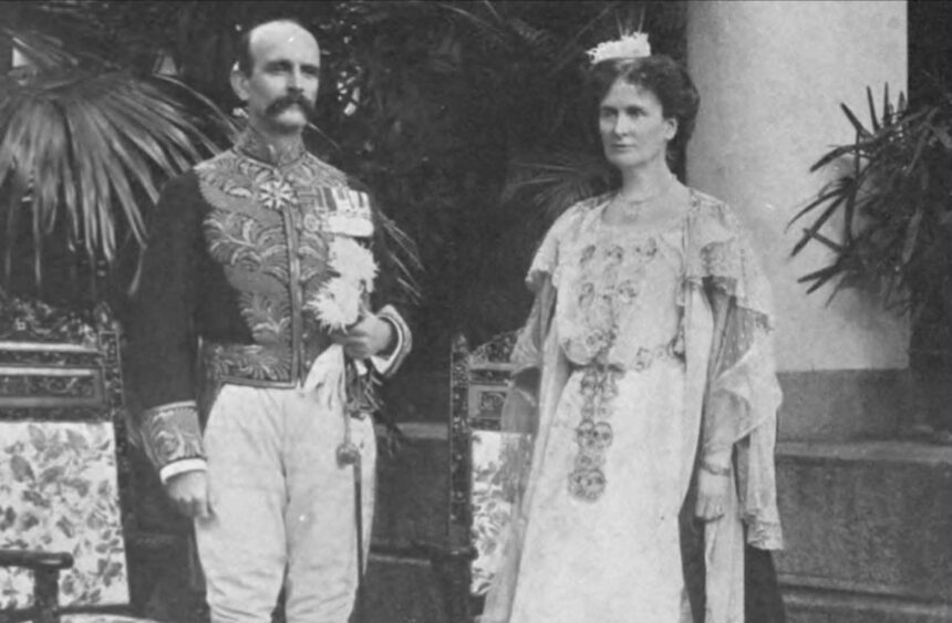
The first High Commissioner appointed to govern the protectorate was Sir Frederick Lugard.
Lugard was already an experienced colonial officer. Before arriving in Northern Nigeria, he had served in Uganda, Nyasaland, and other parts of East Africa. His experiences shaped his belief that colonial territories should be governed through existing traditional rulers wherever possible. This philosophy later became famous as Indirect Rule.
Lokoja Becomes the First Headquarters
When Lugard assumed office in 1900, the new protectorate needed an administrative headquarters.
He selected Lokoja, located at the confluence of the River Niger and River Benue.
Lokoja already possessed significant colonial infrastructure.
British missionaries from the Church Missionary Society had established stations there decades earlier.
The town contained government buildings inherited from earlier administrations.
Its river location made communication with Forcados, Burutu, and the Atlantic coast relatively straightforward during the rainy season.
British steamships could transport officials, soldiers, supplies, and correspondence.
Despite these advantages, Lokoja suffered from serious weaknesses.
It lay at the southern edge of the protectorate.
Many northern emirates remained hundreds of kilometers away.
Military expeditions required weeks or months of travel.
Communications became difficult during seasonal changes.
River navigation depended heavily on water levels.
Most importantly, Lokoja did not occupy a central position from which the enormous protectorate could be efficiently governed.
The Search for a More Strategic Capital
Lugard quickly realized that Northern Nigeria required a capital located closer to the interior.
Between 1900 and 1902, British surveyors, engineers, military officers, and political officials examined several possible locations.
Among the considerations were Jebba, Bida, Keffi, Zaria, and areas along future railway routes.
Lugard established several criteria for the new capital.
It needed to occupy a more central geographical position.
It had to be relatively healthy by the standards of tropical medicine at the time.
It needed adequate land for future expansion.
It had to allow rapid military deployment in every direction.
It required access to transportation routes that could eventually accommodate a railway.
It also had to remain politically neutral, avoiding favoritism toward any major emirate.
Locating the capital inside Kano, Sokoto, or Bida might have strengthened the influence of one traditional state over others. Lugard preferred a location where the colonial government stood above existing political rivalries.
Why Zungeru Was Chosen
After extensive surveys, Lugard selected Zungeru in September 1902.
At the time, Zungeru was a relatively small settlement situated among the hills and valleys inhabited largely by Gbagyi communities, while nearby areas were influenced by the Nupe Kingdom.
The location offered several strategic advantages.
First, it occupied a far more central position than Lokoja.
Government officers could travel more easily toward Kontagora, Bida, Zaria, Keffi, Ilorin, Kano, and Sokoto.
Second, the surrounding hills provided natural defensive advantages.
British military planners believed the terrain would be easier to protect against possible attacks.
Third, the area possessed numerous streams and relatively reliable water sources.
Although later experience revealed important health challenges, contemporary British medical officers initially regarded Zungeru as healthier than many river settlements.
Fourth, sufficient land existed for constructing government offices, military barracks, residential quarters, hospitals, workshops, roads, and future railway facilities.
Finally, Zungeru lay close to the projected route of what would become the Baro to Kano Railway, a project Lugard viewed as essential for connecting Northern Nigeria with international trade.
The Indigenous Communities of Zungeru
Before British occupation, Zungeru was not an empty wilderness.
The surrounding region formed part of a culturally diverse frontier where several ethnic communities interacted.
The Gbagyi, often called Gbari, constituted the oldest known inhabitants of much of the area.
Nearby lived Nupe communities whose influence extended from the powerful kingdom centered at Bida under Etsu Abubakar Kande during this period.
Smaller settlements connected by footpaths and local trade routes supplied food, livestock, pottery, grains, and forest products.
British officials negotiated with local leaders to acquire land for administrative development.
As elsewhere in colonial Africa, these negotiations reflected unequal political power. While some local chiefs accepted British authority in return for recognition or protection, others had little practical ability to resist the expanding colonial administration.
Establishing a New Colonial City
Soon after selecting Zungeru, Lugard ordered government departments to begin relocating from Lokoja.
Engineers surveyed the land.
Roads were cleared through forests.
Temporary government offices were constructed.
Military engineers supervised the building of barracks.
European residential quarters were separated from African settlements according to colonial planning principles of the period.
Thousands of African laborers drawn from different parts of Northern Nigeria participated in clearing vegetation, producing bricks, constructing roads, carrying supplies, and erecting government buildings.
Many worked under compulsory labor arrangements that later became one of the most controversial aspects of colonial administration.
By the end of 1902, the transformation of Zungeru from a quiet settlement into the administrative heart of Britain’s largest West African protectorate had begun.
The decision would permanently alter the history of Northern Nigeria.
In the next part of this series, we will examine how Zungeru developed into the command center of British colonial rule, how Lugard directed military campaigns against the Sokoto Caliphate and other emirates from the town, how Indirect Rule took shape, and how Zungeru became the birthplace of many institutions that later shaped modern Nigeria.
References
Afigbo, A. E. The Making of Modern Nigeria. Longman, 1989.
Crowder, Michael. The Story of Nigeria. Faber and Faber, 1962.
Crowder, Michael. West Africa under Colonial Rule. Hutchinson, 1968.
Flint, John E. Sir George Goldie and the Making of Nigeria. Oxford University Press, 1960.
Lugard, Frederick D. Political Memoranda. Government Printer, Lagos, 1919.
Lugard, Frederick D. The Dual Mandate in British Tropical Africa. William Blackwood and Sons, 1922.
Northern Nigeria Annual Reports, 1900 to 1903.
Perham, Margery. Lugard: The Years of Authority, 1898 to 1945. Collins, 1960.
Tamuno, Tekena N. The Evolution of the Nigerian State. Longman, 1972.
Temple, Charles Lindsay. Native Races and Their Rulers. Argus Printing, 1918.
National Archives, Kew, United Kingdom. Colonial Office Records (CO 446), Northern Nigeria Protectorate Correspondence.
University of Illinois Digital Collections. Northern Nigeria Annual Reports, 1907 and 1908.
Credit: North Book